
Virginia Falls, MacKenzie Mountains, NWT, NW Canada, 90 m high.

Map. We rafted from Virginia falls (centre) to Nahanni Butte.
Our first camp would be at the famous, isolated Virginia falls in the centre of the Nahanni River National Park. There are only 1000 visitors a year in the park and they fly in by chartered float plane, a 240 km flight from Fort Simpson. It is possible to use a boat starting at Nahanni Bute on the Liar River but only the natives use this means of transport as it is a very long boat ride.
The flight from Fort Simpson in a Twin Otter float plane was less than one hour. It felt good to hear the typical high pitch engine noise of the Twin Otter again, my favorite plane, but also, because you never know when they arrive as they tend to be delayed due to the weather.
Virginia Falls is a 96 m high waterfall in a long canyon, the biggest in this region. Impressive, almost twice as high as Niagara Falls which is only 51 m high but is much wider. Trees are smaller in this area and access is along a single trail along the rim so it is difficult to judge the size.
The trails for viewing the falls and used for the portage of canoes and rafts are on permafrost ground and are frequently used. A few years ago Parks Canada made a major investment. A walk board now covers most of the trails, some 2 km in total. The permafrost does make the support poles to move and a few slid off the support during our walks.
We were camping at an elevation of 500 m. The tents are pitched on wooden boards, which is very comfortable. There are only a few mosquitoes as the nights are cold due to the higher elevation in the mountains and relatively few bogs.
The first night went down to freezing which kills mosquitoes. During the day it is 25 degrees Celsius. The sun is very bright and warmest hour of the day is between 5 and 6 PM. The light dims between 1:00 h and 4:00 h in August but it never really gets dark.

Arrival at the first camp at Virginia Falls, 800 meter high mountain in the back-ground (went on top the next day).

Nice wooden platform at the first camp at Virginia Falls.

Virginia Falls, crossing the river in a canoe to go to the 800 m mountain across the river. Rapids and the falls are 500 m down-stream, so, keep paddling hard.

800 m high mountain near Virginia Falls. Trail on the right side of the ridge.
Portage
The float plane can only land above the waterfalls and all the equipment has to be hauled along a 1.5 km trail going down 100 m. The wooden boards help in the use of wheel barrows.
Below the waterfall on the river shore there is a constant mist drifting from the waterfall and tends to display a rainbow. The Wikipedia has a picture with a complete rainbow.

Portage across the waterfalls usng a wheelbarrow.

Cottonwood trees with nice shade.
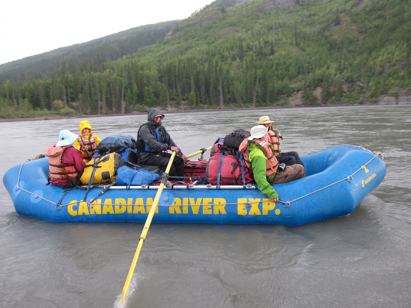
Today was our first day drifting down the river. At the First Canyon, we encountered the biggest rapids of our trip, moderate class I/II rapids. we did get splashed by the cold water, which was the idea. For canoes, the rapids are treacherous, standing waves are one meter and canoes may tip over as happened to one of Ian's friends a few years ago.
We had a very comfortable camp on the side of the river at the edge of the woods with high trees, many are cottonwood trees. Tents were lined up over a distance of 500 m. Not smart when you are in grizzly bear country.
Today was Warm, 25-30 Celsius. I took my first bath in the murky river, very cold! Was in the water for only a few seconds. Got used to it later on during the trip.
My daily bath was the refreshing and relaxing ritual of the day, preferably within half an hour after unpacking and setting up the tents, a strenuous and sweaty exercise by lifting the heavy equipment bags from the boats to the camp site on shore and not clean as we camp on loose gravel and sand.

The Gates camp. View at the 200 moutain. Easy trail up.

The Gates camp. View from the 200 mountain North.
Drifting down the river, few hours to "the Gates", a steep canyon where the river cuts through a 200 m high rock ridge, departing the main, large meander, presumably a split. Very scenic.
We went up the 200 m rock ridge on a good trail. Views were stunning, also the big crack near the edge of the cliff, another few years and this big rock slab will be thundering down into the river. We also saw a ptarmargan with a few chicks.
After the walk I did some more fishing and returned to camp just in time for the pre-dinner snacks and drinks. I was very thirsty and saw the tumbler filled with "lemonade", I thought, like every day, so I filled a large cup and drank it. The lemonade tasted very good but different. I took another cup, while drinking I slowly started to realize this wasn't lemonade but a cocktail of lemonade and a lot of gin, from our only blue Bombay Sapphire gin bottle. For one hour I was dizzy, or is it being drunk? It took a full dinner to wear off the alcohol.
When I bought the license from Parks Canada, I was promised a fish, else I would get my 40 dollars back as the license for foreigners is 4 times more expensive. I never caught anything during the trip, not even after many hours of fishing. In the end, I blamed it on myskills, not the price of the fishing license.

Author fishing. No catch.
In
the morning, around 7:00 h, two wolves were chasing a moose and to
escape, the moose jumped in the river. Alana took a picture of the
moose and saw it disappearing through the gates, drifting with the
flow. Moose are excellent swimmers, but now it would end up in a main
canyon with only few woods and grassy areas. It will have no choice
but to swim the entire length to get out the xxx km long canyon, it
took us 1 or 2 hours drifting down the river. Ritch said that moose
are not very careful animals and after trying to climb on the rocky
shore could easily break their legs. During the trip we saw a dead
moose on the shore in a canyon, drowned from exhaustion, but also a
mother and baby moose happily watching us as the canyon was save.
Moose, jumped in the river, escaping two wolves.

Bushwhack hike, camp across Headless Creek. Ritch searching for a route between the cliffs.

Bushwhack hike, going up in the canyon.
As a day trip Ritch suggested to take a walk along the shore or around our island but this would be a short trip. I proposed we should take advantage of the 800 m mountains around us and try to go up. There was no trail or even a route marked on the map so this would have to be a typical wild bush/mountain hike, my favorite which I have done many times before in various mountain areas in Canada, e.g. Newfoundland was challenging by the dense bushes around the tree line. There was some hesitation, the mountains near us were steep with very dense forest or too steep for the forest to grow. After studying the area and some discussion we decided to give it a try.
Five of us went, including Ritch, our guide. We would follow a ridge North of the camp, starting at the split of a small side stream. Here we saw a large open area above the woods with rocky ridges parallel to the slope.
First half hour was going up steeply in very dense pine bushes to reach the clearing visible from below. We switched to an area with large alder trees (with a white bark) and this turned out to be much easier as there was no small undergrowth.
The clearing started sooner than expected, but was also much steeper than expected, with many rock outcrops and cliffs. Keeping to the right we found a valley going up between steep cliffs. Going left was a poor choice (but possible) as you would be in dense and steep pine woods again, this was the original plan.
We had lunch after around 500 m going up and had clear view down at the camp, see picture.


Bushwhack hike, camp across Headless Creek. View at the camp.
Around 14:00 h, we were close to the top but had to stop. Dark grey clouds were approaching from the West and we heard thunder. Luckily they drifted to the North-East but we were warned, there is a rainstorm in the air. Given the high temperatures of the last few days, we could get heavy rain today.
Back down in the camp, at the same time, wind gusts picked up a few tents in our camp as these were poorly staked to the ground. My tent moved 15 m until it was stopped by two of the guides that stayed in camp that day.
One tent with personal gear inside, Alana's tent, she is one of the guides (!) blew into the water and her sleeping bag inside got very wet. She did manage to dry it kin time for the night.

Bushwhack hike, camp across Headless Creek. Thundershowers to the West, passing by.

Camp across Headless Creek. Tent forced down with rocks, the Innuit way, "tent rings".

Alana, cooking in the rain.
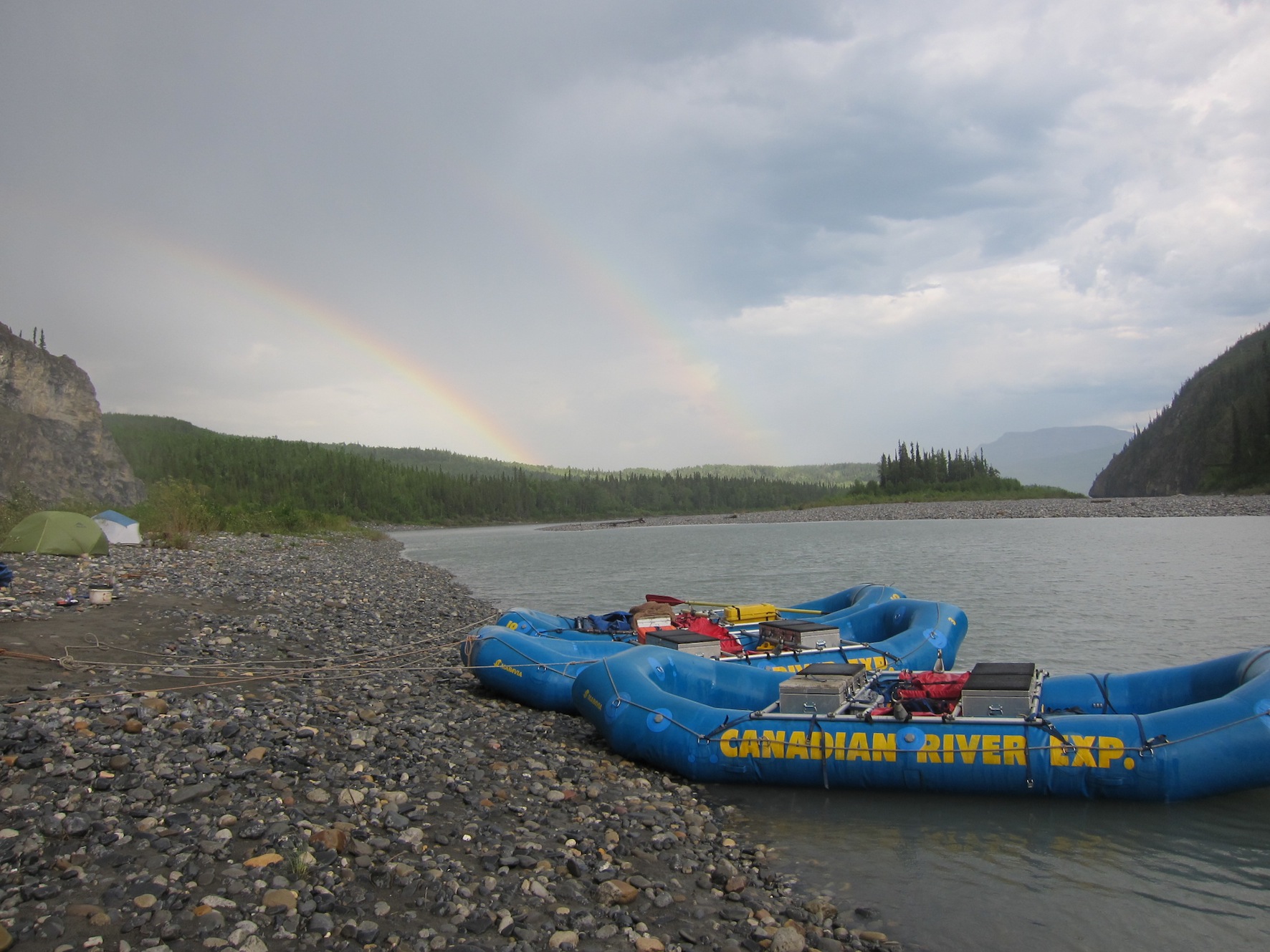
Camp across Headless Creek. Double rainbow.
Warm days, 28 Celsius. Buggy.
Again we had a relaxing two day camp, now on a large flood plain of a river delta.
As we drifted down the river during the trip, the altitude dropped with every new camp site and it got warmer. In the morning it was fine but around 17:00 h the temperature reached its maximum in this area by the very short nights and the wind dies down. Unfortunately, this is also the favorite time for female mosquitoes to hunt for extra proteins.
The combination of the heat and mosquitoes was unpleasant, wearing head nets, not even bug dope worked, and it causing hilarious incidents when eating, try to eat through the net.
We took a walk along the creek for one hour until we hit a canyon with with a deep, fast flowing river we couldn't pass. The trail on the map continues to the North up the mountain but this required crossing the main stream which was too high. Along the way we crossed two side streams with very cold water but going back Ian and I decided to try to follow the edge of the hill with muddy landslides and fallen trees. The mud hardened over the past few month and we didn't sink into it, this is was why most of us avoided this route.
That afternoon the temperature rose again to 28 Celsius and the bugs came out in full swing. Head nets and gloves were again the only way to keep them off. Sitting in the raft was better, the cool river water and some wind kept them at bay somewhat but it wasn't pleasant either.
I went to the mouth of the fast flowing stream to go fishing. Here it is much cooler (only 23 Celsius) compared to the camp as the spray of the cold fast flowing water of the stream cools down the air and the bugs don't like this.
Ritch had the same idea and had his afternoon nap. I took a bath in the cold stream to cool down as well and had an explorers shave.
Later that night, after dinner, I felt very warm again, itchy from the many mosquito bites and felt dirty by the sweat, so I went back to the stream. The cool bugless area kept me there until midnight when the sun went down. Not sure what I did those 3 hours. A fish jumped out of the water and went for my lure but this could be imagination while staring at the fast flowing and noisy water.
Before I left I took another bath to cool down.
The camp in the twilight was very silent. There was no wind so the bugs were out in full force. Got several bites during my quicky bedtime wizz. I again looked at the large flat flood plain but of course saw no animals. During a night like this I wouldn't be surprised if I saw some, perhaps a bear of at least a moose. Unfortunately, they will see you first before you may see them.

Lafferty Creek, 30 Celsius, fierce sun (force 10) around 5 PM.

Lafferty Creek. Tired lead guide (Ritch), afternoon sleep. No mosquitoes near the cold water of the side stream.

Lafferty Creek. Trying to escape the bugs, less near the cold (12 Celsius) water.
Driftng to the “storm in the canyon”, rain.

This camp has a cave in a large rock face but is not accessible as it is closed by the park rangers.
We were puzzled how to get there. Repelling down?
Mountain goats have used this cave for shelter. Many died by sliding down on an ice slope inside as they couldn't get back due to the slippey ice, see below. Some bones are 2000 years old.

Cave Grotte Valerie at Lafayettes Stream in the rock face (top, middle). Full of dead mountain goat bones.


Description of the cave.

Map of the cave system.

Three guides.

Canyoning in 10 Celsius water. 4 km upstream.


Hot water sulfur pools past Lafayettes Creek. A very buggy area. Net cover used by Dagmar.

Even more bug camp, increasing when you go down river.

Mosquitoes on the tent screen when waking up in the morning.

The irreplaceable pee bottle, avoiding going out of the tent at night being bitten and preventing another 10 mosquitoes entering resulting in a nightly hunt.
(text to be completed)

Bugs love warm coffee.

And a warm boat.

Nahanni Butte, village buffalo.

Nahanni Butte. Guides Ritch and Alana in bug shirts, calling the plane.

Hiding for the bugs in the local fire truck in Nahanni Butte.

Pick up, but first the canoe group. 5 hours wait. Nahanni Butte, bug city.

Ritch's hands after two weeks hard work.

Alana's hands after two weeks. She wears gloves.

Three guides at the last dinner.

Grizzly bear print.

Wolf print.
You are visitor: