Jean van Berkel: Photos of Baruntze (7220 m) and trek across Sherpani/East and West Col (6100 m), East Nepal
Photos from a trek in the Baruntse region of Nepal,
October/November 2004.

Route from Makalu across Sherpani/East Col, 6100 m, and Mera La (left) or Everest route (right) to Lukla. Click on picture for full view. After Google Earth.
Sponsored by:
Bever Zwerfsport
Eider
Rab
and powered by Hanwag Yukon boots:
Hanwag

Makalu from the Sherpani/East Col, 6100 m.

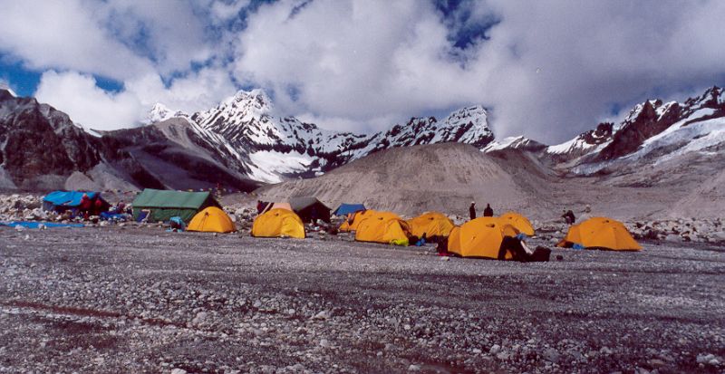
Baruntse Base Camp, 5450 m

Map of day 4 till end
| TITLE (to click on) |
|
| Photographs |
|

Arun valley near Sedua

Maos passage fee receipt in Tashi Gaon

Kharka at Unshisa, 3500 m, wet and muddy after a week of rain, getting ready in the morning

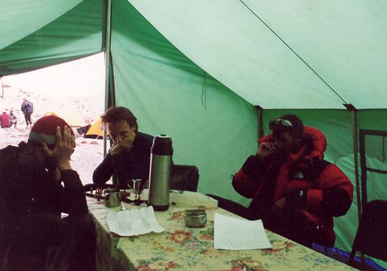
Disco at 4900 m in tea house at Makalu Base Camp (4900 m)

Disco at 4900 m in tea house at Makalu Base Camp (4900 m)
| TITLE (to click on) |
|
| Photographs |
|
| Disco at 4900 m in tea house at Makalu Base Camp (4900 m) | |
| Same | |
| Same | |
| Same | |
| Same | |
| Barun Glacier area, Sherpas going up in the fog | |
| Same, "I have sunshine ..!!!!" sung by Bramzan | |
| Same | |
| Barun Glacier, view at Everest and Lotse, with Santa | |
| Same, | |
| Same, Jean | |
| Same, Jacco and Jean | |
| Same, Jean in front of Makalu | |
| Same. Tomas in front of Makalu | |
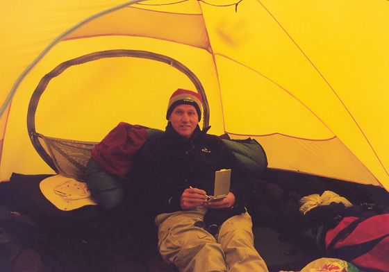
| Camp at 5200 m close to Makalu, between boulders | |
| Lotse and Everest (very vague) above the Barun Glacier from camp at 5200 m close to Makalu, taken at dawn around 6 PM | |
| Makakalu at dawn around 6 PM | |
| Makakalu at dawn around 6 PM | |

Camp below Sherpani/East Col Glacier, with Bramzan

Makalu in de clouds and glacier below Sherpani/East Col

Similar, Makalu and glacier below Sherpani/East Col

Sherpani/East Col Abseil/rappel of 100 m

West Col abseil/rappel of 100-150 m at 6135 m

Koche, 3600 m, Maoist check post

Tea House in jungle

Thuli Kharka, 4300 m

Tea house at the pass to Lukla, 4500 m, cold inside, 5 Celsius
Photographs from Bram

...
Photographs from Peter

Arun Valley region

Arun Valley region

Arun Valley, view to the North. Rain clouds that will follow us for 1 week.

Makalu Base Camp, group photo including the porters

Makalu Base Camp

...

Makalu, with a cloud hood indicating high winds. Sherpani Col (6100 m) is the far ridge.

Monkeys on the Ghokarna golf course in Kathmandu, a former park of the King.
Photographs from Reinhard

Glacier going West to Sherpani=East Col, from 5700 to 6100 m

East side Sherpani/East Col, 6100 m

Abseil on the West side of Sherpani/East Col, 6100 m
Photographs from Steven

High Camp at the West Col, 6135 m. Background ridge to Baruntse (7220 m)

West Col at 6135 m, West cliff to base camp, easy abseil/rappel.

Rappelling down the West Col at 6135 m.